

By Cameron Clark, Dixon Resources Unlimited
A parking inventory tells us what is available. Understanding how people use it means counting vehicles and returning to see what changed. A full block might serve many visitors throughout the day or hold the same vehicles for hours. One count cannot tell us the difference.
Collecting those observations took people. To cover the study area each hour, we generally needed one person for every 20 to 30 block faces. Yet data collection was often treated as a box to check, with the lowest price driving the approach. We wanted to find a way to make studies more cost-effective while producing accurate results.
When a B looked like an 8
Early in my career, a large study could mean 10 to 20 people walking assigned routes with clipboards. Many were new to the work and paid minimum wage or slightly above. It sounded simple: walk around and count cars. We also frequently recorded part of each license plate to track turnover and length of stay for some studies and that added complexity.
Everyone needed to follow the same instructions and stay on schedule. A missed block or late pass could leave a gap we could not fill back at the office.
Then came the field sheets and handwriting. Was that a “B,” an “8,” or even a “Z”? Some entries were unreadable, leaving us unsure whether a vehicle had stayed or another had taken its place.
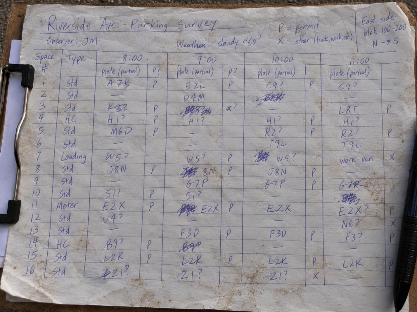
I once found someone making up data in a coffee shop instead of walking their route. I had to redo the collection. Other times, people simply didn't show up or were injured and couldn't complete their routes. That meant finding replacements or rescheduling collection, delaying the project and adding costs. Experiences like that showed how quickly a low-tech approach could become expensive, and why checking the work mattered.
Tablets helped with handwriting, but license plates could still be entered incorrectly, and the process still depended on people manually recording observations. We needed better ways to capture accurate data while reducing the demands on our field teams.
Cameras changed where the work happened
Vehicle-mounted cameras let us cover more ground and keep a visual record. If a count looked questionable, we could return to the footage.
Someone still had to watch that footage and count the vehicles. Collection was faster, but much of the work had simply moved from the street to the screen.
Making LPR work for parking studies

By the time I joined DIXON, the team had been using mobile License Plate Recognition, or LPR, for several years. Capturing plates from a moving vehicle reduced manual recording and supported occupancy, turnover, and length-of-stay analysis across collection periods.
Turning those observations into reliable results still took work. We needed to organize them by location and collection period, process them, and review the results.
Over the years, DIXON has refined how we collect and process LPR data through field experience and development of our Rapid LPR Tool software. Better route planning, gap identification, and quality control have made the process more efficient and accurate while reducing manual steps.
A few well-trained people with the right equipment could now cover work that once required a much larger crew, making collection more efficient and reducing opportunities for error.
Drones added the wider view
Drones gave us a wider perspective and a faster way to collect parking data across large areas. Aerial imagery allows us to count vehicles, visualize occupancy, and capture turnover and length-of-stay data.
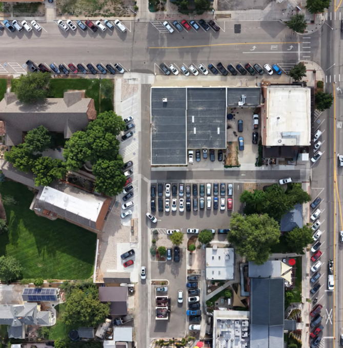
Reviewing thousands of vehicles still takes time, a challenge we have been working to address.
Choosing the method
No single method works for every location. Local policies, weather, tree coverage, visibility, and site conditions all influence our approach. A parking garage, for example, may already have vehicle counts from sensors or entry and exit systems. Often, combining LPR, drones, manual counts, and other available data sources produces the most accurate and complete results.
The choice also affects what we can learn later. Capturing license plates allows us to connect parking observations with permit and payment data, giving us a better understanding of how parking is being used. Those connections opened up new questions and led to the next part of the story.
Next in the series: From Parking Studies to Ongoing Insight
Contact us today to explore how DIXON can help you achieve your goals with innovative, customized solutions.

.svg)
.svg)
