

By Cameron Clark, Dixon Resources Unlimited
Since 2020, drones have been part of DIXON's parking studies, giving our teams and clients a visual snapshot of parking conditions across a block, corridor, or lot. Aerial imagery provides a broad view of the study area and a record we can revisit during analysis.
Over the years, our team has spent thousands of hours reviewing aerial imagery and video, identifying vehicles, counting them, and comparing observations between collection periods.
Occupancy is relatively straightforward to assess from a clear image. Turnover and length of stay require a more difficult comparison: determining whether a vehicle seen during one period is the same vehicle seen later. Repeating that comparison for hundreds of vehicles is time-consuming. That is the processing work DIXON Drone Vision helps us address.
Introducing DIXON Drone Vision

DIXON is excited to introduce DIXON Drone Vision, our new tool for AI-supported aerial imagery data processing. It helps our team turn drone imagery into occupancy, turnover, and length-of-stay analysis by assisting with vehicle detection and comparison across collection periods.
We developed it because flying the drone was only part of the job. Once the imagery was collected, our team still had hours of review ahead of them.
Where AI helps
DIXON Drone Vision uses artificial intelligence and computer vision to assist with vehicle detection, classification, and comparison, automating portions of the repetitive processing. This helps our team move through more imagery efficiently and spend more time reviewing and interpreting the results.
The observations support occupancy analysis to show how many vehicles are present, along with turnover and length-of-stay estimates based on which vehicles appear across collection periods. Images taken at intervals do not capture every arrival and departure between flights, so we plan collection and interpret the findings with those limits in mind.
Review remains part of the work
Our team evaluates the AI's output, investigates inconsistencies, and validates the data before it becomes part of a final analysis. The experience gained through years of manual review helps guide that process. AI-assisted processing is one part of DIXON's quality-control workflow.
A practical option when data is limited
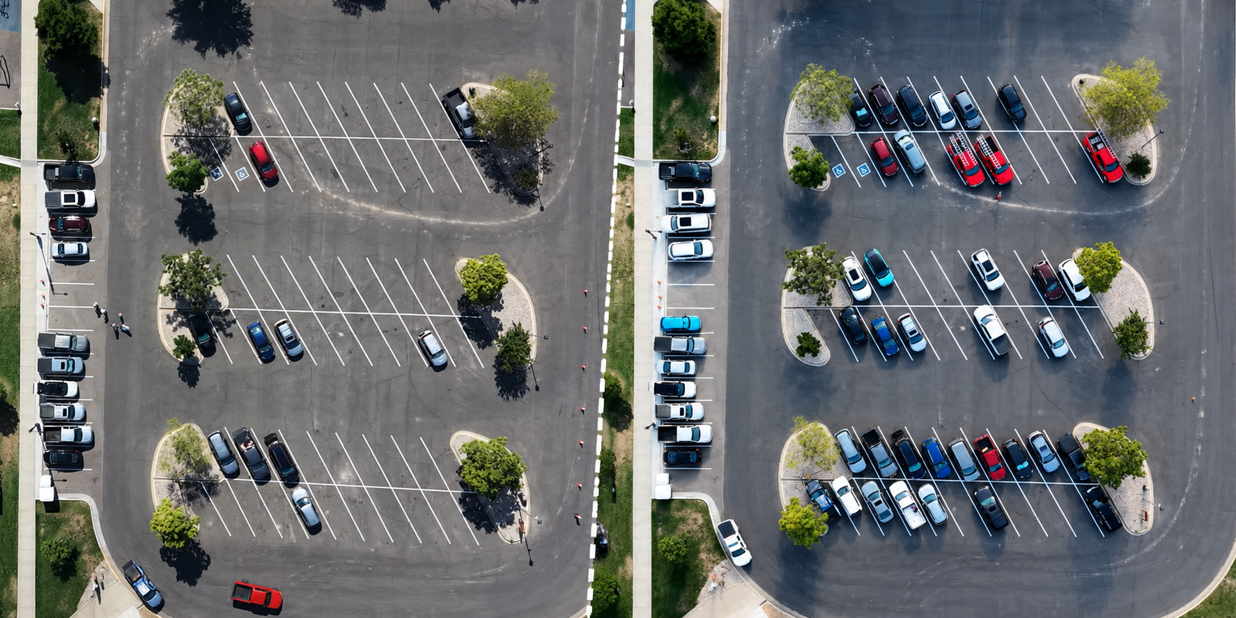
For cities that do not regularly collect LPR, payment, or other parking data, a targeted study may be the most practical way to understand parking use. It can show current conditions, help assess a policy change, or answer a question about a particular location or time without installing permanent monitoring equipment.
For agencies already collecting parking data, aerial imagery can show areas their other sources miss and help check whether the numbers match what is happening on the ground. DIXON Drone Vision helps our team process that imagery more efficiently in either situation.
Bringing the results into DIXON Data Suite®
Through the DIXON Data Suite®, agencies can explore study results alongside parking inventory and aerial imagery. Available LPR, transactions, permits, and enforcement data can add context, but targeted study results can also be used independently.
Seeing the results against an actual view of the study area helps staff review conditions and explain findings to decision-makers and the public.
Matching the tool to the project
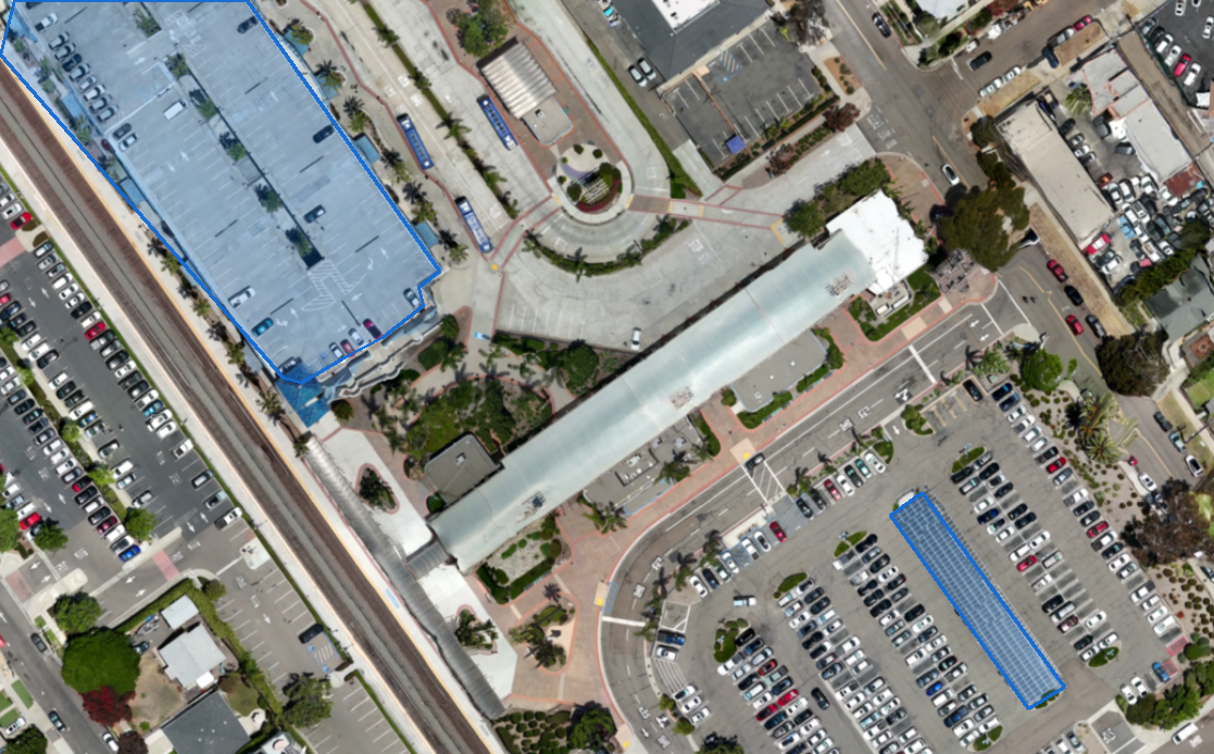
Getting useful drone data takes planning. Airspace rules, site conditions, weather, visibility, and flight safety all factor into whether a drone is the right tool. DIXON selects the collection approach around the project's geography, budget, and questions.
From my first days with a measuring wheel, the goal has been to make parking data easier to collect and use. Each improvement has addressed a part of the work we knew firsthand. DIXON Drone Vision continues that effort, giving our team more time to review findings and help agencies understand what they mean for their parking programs.
Contact DIXON to learn how DIXON Drone Vision and the DIXON Data Suite® can support your next parking study.
Contact us today to explore how DIXON can help you achieve your goals with innovative, customized solutions.


